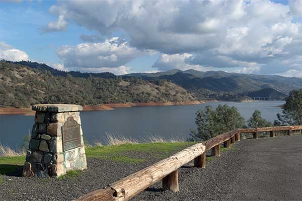
California Historical Landmarks in Tuolumne County
California Historical Landmark 419
Jacksonville
State Route 120 Vista Point North of Don Pedro Bridge
3.5 Miles Southeast of Chinese Camp

(Click the Photo to Read the Plaque)
Near this site, now inundated by the waters of Don Pedro Reservoir, stood the historic town of Jacksonville. It was settled by Julian Smart who planted the first garden and orchard in the spring of 1849. Named for Colonel A.M. Jackson. In 1850 it was the principal river town in the area. It was the gathering center for thousands of miners working the rich bed of the Tuolumne River.
Plaque placed by the State Department of Parks and Recreation in cooperation with the Golden Chain Council of the Mother Load and the 120 Highway Association. November 19, 1971.

The damming of rivers and creeks inundated many 19th century cemeteries, buildings and entire towns.
Bagby (Merced River)
Bidwell's Bar (Feather River)
Camanche (Mokelumne River)
Condemned Bar (American River)
Jacksonville (Tuolumne River)
Middle Bar (Pardee River)
Mormon Island, (American River)
Negro Hill (American River)
Poverty Bar (Mokelumne River)
Reynold's House (Silver Creek)
Salmon Falls (American River)
Searsville (Corte Madera Creek)
Whiskeytown (Clear Creek)
The town of Volcano in Amador County had a close call in 1934 but was granted a reprieve and survives today.