San Francisco Points of Interest
Lincoln Park
Completed 1915
37°47'06.0"N 122°29'57.7"W
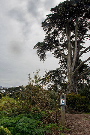
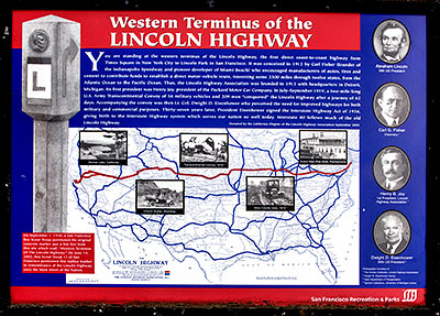
You are standing at the western terminus of the Lincoln Highway, the first direct coast-to-coast highway from Times Square in New York City to Lincoln Park in San Francisco. It was conceived in 1912 by Carl Fisher (founder of the Indianapolis Speedway and pioneer developer of Miami Beach) who encouraged manufacturers of autos, tires and cement to contribute funds to establish a direct motor-vehicle route, traversing 3,300 miles through 12 states, from the Atlantic Ocean to the Pacific Ocean. Thus, the Lincoln Highway Association was founded in 1913 with headquarters in Detroit, Michigan. Its first president was Henry Joy, president of the Packard Motor Company. In July, 1919, a two-mile-long U.S. Army Transcontinental Convoy of 56 vehicles and 209 men "conquered" the Lincoln Highway after a journey of 62 days. Accompanying the convoy was then Lt. Colonel Dwight David Eisenhower who perceived the need for improved highways for both military and commercial purposes. Thirty-seven years later, President Eisenhower signed the Interstate Highway Act of 1956, giving birth to the Interstate Highway system which serves our nation so well today. Interstate 80 follows much of the old Lincoln Highway.
Donated by the California Chapter of the Lincoln Highway September 2005

The Lincoln Highway
The Lincoln Highway, conceived in 1912 and formally dedicated October 31, 1913, was the first road to cross the United States. It ran from Times Square in New York City to Lincoln Park in San Francisco passing through thirteen states: New York, New Jersey, Pennsylvania, Ohio, Indiana, Illinois, Iowa, Nebraska, Colorado, Wyoming, Utah, Nevada, and California.
In 1925, the US Bureau of Public Roads eliminated named trails and highways, and Lincoln Highway became drab series of numbers: US 1, US 30, US 40, US 50.
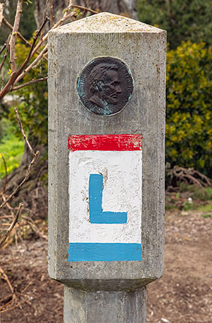
One of the last actions of the Lincoln Highway Association before it closed, was to order the casting of 3,000 concrete markers, to dedicate the highway to the memory of Abraham Lincoln. A rectangular head on top of a hexagonal shaped post, the markers featured the Lincoln Highway logo, a bronze medallion and arrows to indicate the route of the memorial highway. The US Bureau of Public Roads allowed the placement of these markers along the length of the old highway.
According to the 1916 edition of the Lincoln Highway Association Official Road Guide, a trip from the Atlantic to the Pacific was "something of a sporting proposition" and might take twenty to thirty days. Motorists were advised to top off their gasoline at every opportunity and to wade through water before driving through to verify the depth. Recommended equipment included chains, a shovel, an axe, jacks, tire casings, inner tubes and sundry tools. Firearms were not necessary, but west of Omaha full camping equipment was recommended.
Source: Lincoln Highway Association and others.


