NoeHill Travels in Utah
Historic Sites and Points of Interest in Garfield County

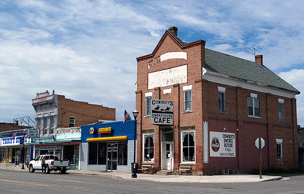
Cowboy's Smokehouse Cafe on the Main Drag in Panguitch

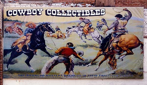
Cowboy Collectibles on the Main Drag in Panguitch, Utah
The Bronco Busters Breaking in Their Fractious Steeds
An Act That Is Never Twice Alike and Full of Daredevil Fun
Both Photos 5 August 2008
(Click Photos To Zoom)
| Name | Address | City | Year | Authority | ID | Sort Address | Sort Name |
|---|---|---|---|---|---|---|---|
| Boulder Elementary School | State Route 12 Near Lower Boulder Road | Boulder | National | 1985000805 | Highway 012 | Boulder Elementary School | |
| Bryce Canyon Airport | State Route 12 Near Rubys Inn | Rubys Inn | 1938 | National | 1978002660 | Highway 012 | Bryce Canyon Airport |
| Bryce Canyon Historic District (Boundary Increase) | Bryce Canyon National Park | Bryce Canyon National Park | National | 1995000434 | Bryce | Bryce Canyon Historic District (Boundary Increase) | |
| Bryce Canyon Lodge and Deluxe Cabins | State Route 63 | Bryce Canyon National Park | National | 1987001339 | Highway 063 | Bryce Canyon Lodge and Deluxe Cabins | |
| Bryce Canyon National Park Scenic Trails Historic District | Bryce Canyon National Park | Bryce Canyon National Park | National | 1995000422 | Bryce | Bryce Canyon National Park Scenic Trails Historic District | |
| Bryce Inn | HS-118 | Bryce Canyon National Park | National | 1995000425 | HS-118 | Bryce Inn | |
| Coombs Village Site | State Route 12 Near Lower Boulder Road | Boulder | National | 1976001815 | Highway 012 | Coombs Village Site | |
| Escalante Tithing Office | 400 South Center Street | Escalante | National | 1985003670 | Center S 400 | Escalante Tithing Office | |
| Hole-in-the-Rock Trail | Hiking and 4WD Trail From Escalante to Bluff | Glen Canyon National Recreation Area | National | 1982004792 | Trail Hole | Hole-in-the-Rock Trail | |
| Horse Barn | HS-48 | Bryce Canyon National Park | National | 1995000433 | HS-048 | Horse Barn | |
| Kolb Brothers "Cat Camp" Inscription | Near Big Drop Two of Colorado River | Canyonlands National Park | National | 1988001250 | Colorado | Kolb Brothers "Cat Camp" Inscription | |
| Loop C Comfort Station | HS-36 in North Campground | Bryce Canyon National Park | National | 1995000428 | HS-036 | Loop C Comfort Station | |
| Loop D Comfort Station | HS-37 in North Campground | Bryce Canyon National Park | National | 1995000429 | HS-037 | Loop D Comfort Station | |
| Oak Creek Dam | Oak Creek West of State Route 12 | Dixie National Forest | National | 1999001091 | Highway 012 | Oak Creek Dam | |
| Old Administration Building | HS-31 | Bryce Canyon National Park | National | 1995000430 | HS-031 | Old Administration Building | |
| Old National Park Service Housing Historic District | HS-2 Through HS-10 | Bryce Canyon National Park | National | 1995000424 | HS-002 | Old National Park Service Housing Historic District | |
| Owens House | 95 North 100 East Street | Panguitch | National | 1999000399 | North 100 | Owens House | |
| Panguitch Carnegie Library | 75 East Center Street | Panguitch | National | 1984000148 | Center E 075 | Panguitch Carnegie Library | |
| Panguitch Tithing Office-Bishops Storehouse | One Hundred East and Center Streets | Panguitch | 1884 | National | 1985003664 | East | Panguitch Tithing Office-Bishops Storehouse |
| Panguith Social Hall | 50 East Center Street | Panguitch | National | 1998001376 | Center E 050 | Panguith Social Hall | |
| Rainbow Point Comfort Station and Overlook Shelter | HS-58 and HS-59 on State Route 63 | Bryce Canyon National Park | National | 1995000427 | Highway 063 | Rainbow Point Comfort Station and Overlook Shelter | |
| Riggs Spring Loop Trail | Trail Head at Yovimpa Point | Bryce Canyon National Park | National | 1995000431 | Trail Riggs | Riggs Spring Loop Trail | |
| Starr Ranch | West of State Route 276 in Henry Mountains | Henry Mountains | National | 1976001816 | Highway 276 | Starr Ranch | |
| Under-the-Rim Trail | Trail Head at Yovimpa Point | Bryce Canyon National Park | National | 1995000423 | Trail Under | Under-the-Rim Trail | |
| Utah Parks Company Service Station | HS-117 | Bryce Canyon National Park | National | 1995000426 | HS-117 | Utah Parks Company Service Station | |
| Panguitch Stake Tabernacle | East Center Street at 100 East Street | Panguitch | POI | Center | Panguitch Stake Tabernacle |