National Register of Historic Places in Marin County
Point Bonita Light Station Historic District
Point Bonita
Marin Headlands
Built 1855 and 1877
Point Bonita Light Station Historic District consists of 140 acres with one building and two structures of historical significance. The building is the fog signal. The structures are the lighthouse and the tunnel.
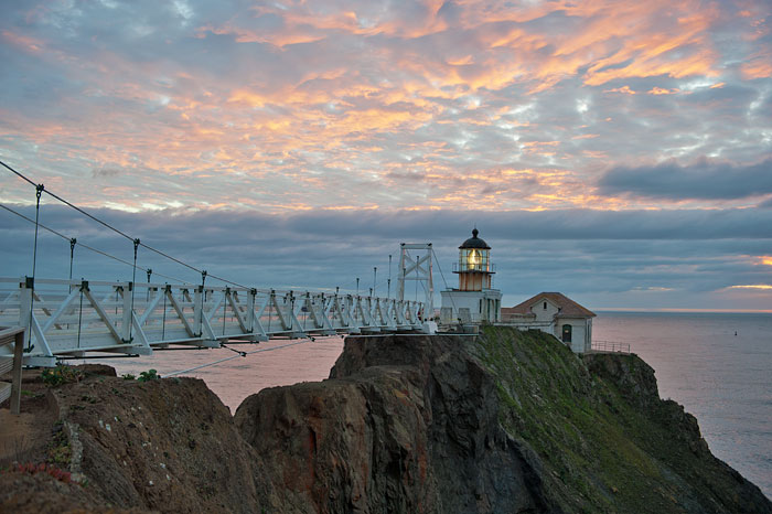
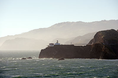
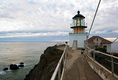
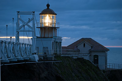
Point Bonita Light Station is located at the tip of Point Bonita, a rocky promontory marking the northern entrance to San Francisco Bay. The lighthouse tower and adjacent fog-signal building are built on narrow ledges blasted out of solid ridge top rock. These are the only significant structures remaining from many older buildings and structures that were demolished. A picturesque pedestrian suspension bridge connects the light station's buildings to the ridgetop trail.

The Coast Survey of 1849 recommended sixteen lighthouses for California, four of them in the Bay Area: Alcatraz, Fort Point, Farallon Islands and Point Bonita.
The Gold Rush had just made San Francisco a boom town. San Francisco Bay was filled with maritime traffic from around the world.
Despite urgent need for a lighthouse at the entrance to the Bay, Congress did not fund Point Bonita Lighthouse until 1853.
Meanwhile, scores of ships were wrecked while trying to find safe passage into the Bay. Few captains dared sail their vessels through the Golden Gate after sundown. Even ships approaching in the daytime encountered fogs, swift currents, and other navigational hazards. The largest wreck to occur in the vicinity of Point Bonita was that of the sidewheeler steamship Tennessee on March 6, 1853.
The first Point Bonita lighthouse was finally built in 1855.

Extreme isolation contributed to the unhappiness of lighthouse employees. Early lighthouses were serviced by infrequent tenders. The nearest provisions were in San Francisco, a three hour trek over mountainous terrain to Sausalito then a steamboat to The City. Meager government salaries had scant purchasing power in Gold Rush San Francisco. By March of 1856, just ten months after the station opened, Point Bonita had gone through two keepers and five assistant keepers.
The issue of the isolation was resolved somewhat in the 1860's with more ranches in the area and a new overland trail to Sausalito. But the issue of low pay near a high-priced city would plague lighthouse personnel for the rest of the 19th century and through the beginning of the 20th.

After several years of operation it became obvious that Pacific Coast fogs often occurred at a higher elevation than the ocean fogs of the East. The Point Bonita light would often be obscured by fog at the 300 foot level, while lower elevations remained clear. Lighthouse authorities decided that a new tower and fog signal would need to be constructed on the tip of the point at a much lower elevation.
The precarious terrain made construction difficult. A tunnel was cut through the side of the rock in 1876 to eliminate the cliff-hanging wooden platform that skirted the two hundred foot shear cliff. A landing was also constructed with a winch and lift to haul material up the side of the cliff.
The new fog-signal, an up-to-date steam siren, was completed in 1872. A portion of the fog-signal building fell to the sea in a winter storm two years later.
In 1875 the tip of the point was leveled and the fog-signal building pulled back from the edge of the cliff. The new lighthouse began operating in 1877. It was composed of a new one-story brick base and the relocated lantern room and lens from the original lighthouse. A dome was added to the top of the former lighthouse and it became used as a daymark.

The present fog-signal building was constructed in 1903, replacing the previous fog-signal buildings built in 1872 and 1875. A new keeper's duplex was completed in 1908, the previous one having been rendered uninhabitable by the 1906 earthquake.
The suspension bridge was built in 1954. Years of erosion had produced an unrepairable chasm that could only be spanned by a bridge.
In 1980, Point Bonita Lighthouse was the last California lighthouse to be automated.
In 1981, the historic district was transferred to the National Park Service and was opened for tours in 1984. It is located within the Golden Gate National Recreation Area.

Battery Point Lighthouse, Crescent City
Cape Blanco Lighthouse, Curry County, Oregon
East Brother Light Station, Contra Costa County
Fort Point Lighthouse, San Francisco
Point Arena Light Station, Mendocino County
Point Bonita Light Station, Marin County
Point Cabrillo Light Station, Mendocino County
Point Montara Light Station, San Mateo County
Point Reyes Light Station, Marin County
Pigeon Point Lighthouse, San Mateo County
St. George Reef Light Station, Crescent City
Yerba Buena Island Lighthouse, San Francisco


