National Register of Historic Places in Sierra County
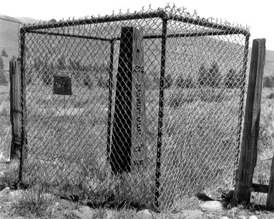
1872 California-Nevada State Boundary Marker
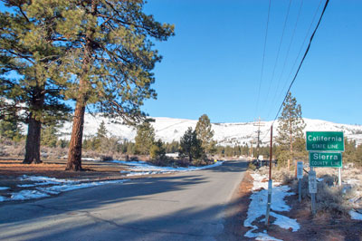
Dog Valley Road At California/Nevada Border West of Verdi, Nevada
Verdi
The 1849 Constitution of the State of California specified how the border between California and Nevada would be determined. The northern point would be 39ºN 120ºW. The border would then run due south to 42ºN 120ºW (in the middle of Lake Tahoe), then southeast to the Colorado River, then downriver to Mexico.
The actual surveys took decades. Between 1855 and 1900, six different surveys were made. None of them agreed as to the location of the boundary or even the location of the 120th meridian.
The 1872 Von Schmidt survey was the only one that was clearly marked along its entire length with stone, rock, wood and iron markers. The Von Schmidt marker near Verdi was Von Schmidt's initial location point for the 120th meridian.
In 1893, the Von Schmidt line was found to be 1,600 to 1,800 feet too far west. Even after 1893, the Von Schmidt line remained the accepted boundary and is still used more today than the more accurate 1893 version.
Both the 1872 and 1893 lines have been recognized and are used by both California and Nevada.
Adapted from the NRHP nomination submitted in 1981.

We were unable to locate the 1872 marker. A return trip after the snow melts is indicated.

The Von Schmidt boundary marker is listed on the National Register of Historic Places in both California and Nevada.
We returned to this spot in 2016 to find that the citizens of Verdi, Nevada, had created the Von Schmidt Monument Historic Park to commemorate the boundary marker and other historical events in the area.

