National Register of Historic Places in Sierra County
Foote's Crossing Road
Tyler Foote Road
Tahoe National Forest Between Columbia Hill in Nevada County and Alleghany in Sierra County
Built 1913
Foote's Crossing Road is a 15.1 mile stretch of unpaved county road extending from the site of Columbia Hill in Nevada County to the small community of Alleghany in Sierra County. This 1913 road is still in use.
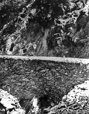
The road is notable the rugged beauty of the river canyon it traverses, for the skillful manner in which the road negotiates the precipitous descent into the canyon while maintaining an even seven percent grade, and for the visual beauty and craftsmanship associated with a drylaid rock wall which comprises the bed and retaining wall for approximately one mile of the road in Nevada County.
The road is named for Arthur DeWint Foote (1849-1933), a distinguished Western surveyor and mining engineer. In 1911, Foote headed a group of investors which purchased the Tightner Mine near Alleghany.
The road from the railroad terminus at Nevada City to the Alleghany mines was virtually impassible during most of the year and closed altogether during winter months when supplies were packed in and gold packed out by men on skis. Even in good weather, it took five days to carry goods from Nevada City to the mines and back. Foote envisioned a new road which could be travelled all year in a round trip of three days.
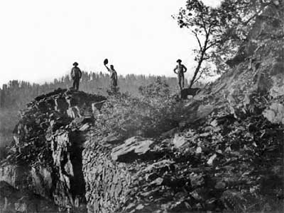
The final descent into Middle Fork Canyon from the Nevada County side, a nearly vertical drop of hundreds of feet, posed the most challenging aspect of the undertaking. Foote's solution was to hang a rock shelf along the precipice. Skilled Italian, Swiss, and Slovenian stone masons were employed for the dangerous and intricate task of blasting the rock from the face of the mountain and shaping and fitting the stone to form a rock ledge.
In some areas, workers were lowered on stagings hanging 1500 feet above the river bed. Steel eyelets were driven into the rock cliff to hold the new rock wall, which was entirely dry-laid. Horse-drawn dragline scrapers leveled the roadbed.
During his career, Arthur Foote also worked on the Comstock Lode Sutro Tunnel, the New Almaden quicksilver mine near San Jose, the Tehachapi Pass Route of the Southern Pacific Railroad, Golden Gate Park in San Francisco, and the Idaho Land Irrigation Company on the Boise River. In 1895, Foote settled in Grass Valley where he served as chief of operations for the North Star Mines until his retirement in 1913.
Adapted from the NRHP nomination.

