National Register of Historic Places in Placer County
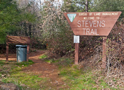
Stevens Trail
Trailhead at Terminus of North Canyon Way
Colfax
Completed c1870
The Stevens Trail was originally owned and surveyed by gold miner John Rutherford who soon partnered with another miner, Truman A. Stevens, to build the road connecting the Gold Rush towns of Illinoistown and Iowa Hill, separated by the steep canyon of the North Fork of the American River.
Their toll road was active from 1870 until 1895. It was largely forgotten for sixty years until its revival as a hiking trail from Colfax - formerly known as Illinoistown - to the confluence of Secret Ravine and the North Fork of the American River.
More information about hiking the Stevens Trail is available at the Bureau of Land Management website.

The Stevens Trail provided transportation between the communities of Iowa Hill and Colfax where a transcontinental railroad office opened in September of 1865.
The Stevens Trail also provided access to the placer gold bars on the North Fork of the American River and the mines along its route for over 130 years. It probably linked several settlement sites, at least one of which was Chinese, with Colfax, and possibly tied to a segment of the Central Pacific Railroad at Cape Horn.
The Stevens Trail is typical of mid-19th century pack trails in the Mother Lode, but while other Mother Lode trails evolved through use and need, the Stevens Trail was an engineered alignment, surveyed with instruments. It is direct, even in gradient and free of switchbacks.
The Stevens Trail shares many features with other pack trails located in the canyons of the western Sierra Nevada. The surface is compacted earth routed through side-hill cuts and supported by polycoursed rock retaining walls. The trail is supported at drainages and curves by dry-laid rock walls. At least two segments of the walls are supported by metal bars set into bedrock beneath the trail, cantilevered over the river bed hundreds of feet below.
The identity of the actual builders is unknown. Pack trails were ubiquitous in the Mother Lode and constructed by persons of various ethnicities and occupations, all in a rush to complete transportation routes between mining areas and trade centers.
The Stevens Trail remains essentially unchanged since its construction except for about one thousand feet which were overlain by the construction of a logging road in 1978. Of the several toll roads and trails which crossed the North Fork of the American River during the latter half of the 19th century, only two are still in use, the Stevens Trail and the Michigan Bluff-Last Chance Trail.
Source: Adapted from the NRHP nomination submitted in 2002.
