California Historical Landmarks in Alpine County
California Historical Landmark 318
Ebbetts Pass Route
State Route 4
Toiyabe National Forest


(Click Photos to Zoom)
The Emigrant Trail through Ebbetts Pass, discovered by and named after 'Major' John Ebbetts, was opened up in the early 1850s, but no wagon road went that way until 1864, when a toll road, under the name of Carson Valley and Big Tree Road, was completed to help open up the Comstock Lode in Nevada.
Citation from California Office of Historic Preservation

We were unable to locate a bear flag plaque for this landmark. Here's a list of other California Historical Landmarks which had no bear flag plaque when we visited them.


(Click Photo to Zoom)
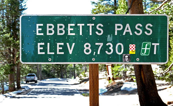
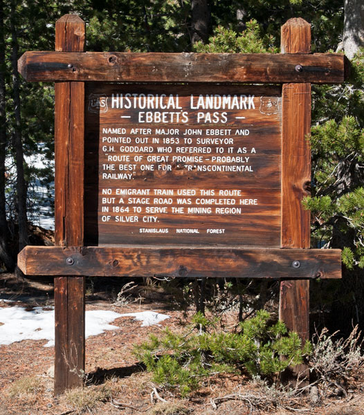
Ebbett's Pass
Named after Major John Ebbett and pointed out in 1853 to surveyor G.H. Goodard who referred to it as a "route of great promise - probably the best one for a transcontinental railway."
No emigrant train used this route but a stage road was completed here in 1864 to serve mining region of Silver City.
Stanislaus National Forest

How Did John Ebbetts Spell His Name?
In researching Ebbetts Pass, I have come across four spellings: Ebbetts, Ebbet's, Ebbett's, Ebbetts'. According to different sources, the pass was named after either "Major" Ebbetts or Major Ebbets or "Major" Ebbett. The word major is usually, but not always, in quotes.
State Route 4 is the Ebbetts Pass National Scenic Byway, one of seven National Scenic Byways in California as of August 2013. The Ebbetts Pass National Scenic Byway website uses Ebbetts (double-b, double-t, no apostrophe) as the name of the man and the pass:
Jedediah Strong Smith appears to have been the first Euro-American to enter the region. From his camp on the lower Stanislaus River, Smith and two companions traveled eastward, upstream, and crossed the Sierra Nevada in eight days during May of 1827. It is thought that the path traveled by Smith and his fellow trappers may have paralleled the present Highway 4...."Major" J.A.N. Ebbetts claimed to have led a group of miners and mules east over the Sierras in 1851, using a snow-free pass at the headwaters of the Mokelumne River. Later, in 1853, he led a railroad survey team across the Sonora Pass region. From a high peak just east of Sonora Pass he pointed north to the pass he thought he took in 1851 to George Goddard, a mapmaker.
In 1854, Ebbetts died in a steamer explosion. In memoriam, Goddard placed the name Ebbetts Pass on the map he completed in 1856, approximately in the region he thought Ebbetts had pointed out. It was not until 1893, however, that the U.S. Geological Survey team, in drafting the Markleeville Quadrangle, officially named the location for Ebbetts.
The book, California Place Names by Erwin G. Gudde, gives the following citations for Ebbetts Pass:
- From page 90 of the 1854 Surveyor General Report: "the pass we called Ebbets' pass, in memory of Major Ebbets who went over it in the spring of 1851, with a large train of mules, and who found no snow there in April."
- John Ebbetts came to California in 1849 as captain of the Knickerbocker Exploring Company, and died April 15, 1854, in the wreck of the Secretary in San Pablo Strait.
- From the Whitney Survey, Geology I: "In 1863 this was a simple trail, and it crossed the route designated on Britton and Rey's map as 'Ebbett's Pass'; this name is, however, no longer known in the region, as we could find no one who had ever heard of it.
- The old name was restored when the Geological Survey surveyed the Markleeville quadrangle in 1893.