Historic Sites and Points of Interest in Tehama County
25 September 2006
Tehama County was created in 1856, six years after California became a state, by carving out and combining parts of three neighboring counties - Butte, Colusa, and Shasta.
The origin of the word Tehama is hopelessly obscure according to Erwin G. Gudde (California Place Names, Third Edition, 1969, University of California Press). Tehama may have been derived from the name of an Indian tribe, an Indian village, an Indian word for prairie, an Arabian city near Medina, an Arabian word meaning "hot lowlands," or an Aztec word for shingle.
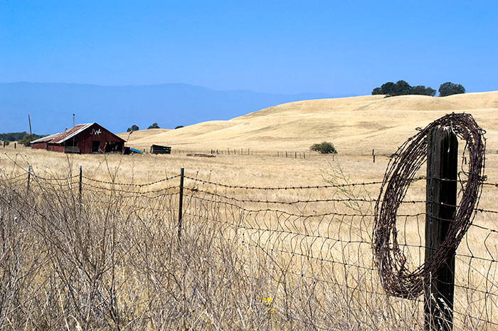
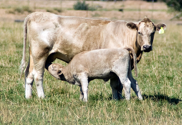
Like all of the Central Valley, Tehama County is historically agricultural. The Tehama County Farm Bureau lists the top five crops as walnuts, almonds, prunes, olives, and milk.
Tehama County, along with neighboring counties, is located in the proposed 51st State of Jefferson.
| Name | Address | City | Year | Authority | ID | Sort Address | Sort Name |
|---|---|---|---|---|---|---|---|
| Brown Home | 135 Main Street | Red Bluff | 1864 | California | 117 | Main 0135 | Brown Home |
| Bruff's Camp | Forest Service Road 27N08 | Rural | POI | 27N08 | Bruff's Camp | ||
| Cone and Kimball Building | 747 Main Street | Red Bluff | 1886 | National | 1979000564 | Main 0747 | Cone and Kimball Building |
| Corning Carnegie Library | 618 4th Street | Corning | 1915 | POI | Street 04 0618 | Corning Carnegie Library | |
| Corning Masonic Hall | 1124 Solano Street | Corning | POI | Solano 1124 | Corning Masonic Hall | ||
| Corning Transportation Center | 1081 Solano Street | Corning | 1998 | POI | Solano 1081 | Corning Transportation Center | |
| Corning Veterans Building | 1648 Solano Street | Corning | POI | Solano 1648 | Corning Veterans Building | ||
| Forward Brothers Sawmill | Forward Road at Forwards Mill Road | East of Manton | POI | Forward | Forward Brothers Sawmill | ||
| Hennessy House | 31245 Manton Road | Manton | POI | Manton | Hennessy House | ||
| Hotel Maywood | 1110 Solano Street | Corning | 1899 | POI | Solano 1110 | Hotel Maywood | |
| Ide Adobe | 21659 Adobe Road | Red Bluff | 1850 | California | 12 | Adobe 21659 | Ide Adobe |
| Ide Adobe Plaque | 520 Adobe Road | Red Bluff | 1850 | California | 12 | Adobe 00520 | Ide Adobe Plaque |
| Kraft Free Library | 909 Jefferson Street | Red Bluff | 1909 | National | 2000000362 | Jefferson 0909 | Kraft Free Library |
| Lassen Trail 1848-1849 | State Route 36 | Mill Creek | 1848 | POI | Route 036 | Lassen Trail 1848-1849 | |
| Lassen Trail 48 | State Route 32 | Rural | POI | 032-200 | Lassen Trail 48 | ||
| Lassen Trail 49 | OHV Road | Rural | POI | OHV | Lassen Trail 49 | ||
| Lassen Trail 50 | Lassen Trail | Rural | POI | Lassen | Lassen Trail 50 | ||
| Lassen Trail 51 | Lassen Trail | Rural | POI | Lassen | Lassen Trail 51 | ||
| Lassen Trail 52 | Lassen Trail | Rural | POI | Lassen | Lassen Trail 52 | ||
| Lassen Trail 53 | Lassen Trail | Rural | POI | Lassen | Lassen Trail 53 | ||
| Lassen Trail 54 | Lassen Trail | Rural | POI | Lassen | Lassen Trail 54 | ||
| Lassen Trail 55 | Lassen Trail | Rural | POI | Lassen | Lassen Trail 55 | ||
| Lassen Trail 56 | Lassen Trail | Rural | POI | Lassen | Lassen Trail 56 | ||
| Lassen Trail 57 | Lassen Trail | Rural | POI | Lassen | Lassen Trail 57 | ||
| Lassen Trail 58 | Hiking Trail | Ishi Wilderness | POI | Hiking | Lassen Trail 58 | ||
| Lassen Trail 59 | OHV Road | Rural | POI | OHV | Lassen Trail 59 | ||
| Lassen Trail 60 | OHV Road | Rural | POI | OHV | Lassen Trail 60 | ||
| Lassen Trail 61 | Leininger Road | Vina | POI | Leininger | Lassen Trail 61 | ||
| Lassen Trail 62 | 26240 7th Street | Vina | POI | Street 007 | Lassen Trail 62 | ||
| Lassen Volcanic National Park Headquarters | State Route 36 | Mineral | 1929 | National | 1978000294 | Route 036 | Lassen Volcanic National Park Headquarters |
| Manton Schoolhouse | 31345 Forward Road | Manton | POI | Forward | Manton Schoolhouse | ||
| Manton Store | Manton Road and Forward Road | Manton | POI | Manton | Manton Store | ||
| Maywood Woman's Club | 902 Marin Street | Corning | 1898 | National | 1992001301 | Marin 0902 | Maywood Woman's Club |
| Miners Inn | 1301 Solano Street | Corning | 1882 | POI | Solano 1301 | Miners Inn | |
| Molino Lodge Building | 3rd and C Streets | Tehama | 1859 | National | 1980000874 | Street 03 | Molino Lodge Building |
| Nomi Lackee Indian Reservation | Osborn Road | Flournoy | 1854 | California | 357 | Osborn | Nomi Lackee Indian Reservation |
| Odd Fellows Building | 342 Oak Street | Red Bluff | 1882 | National | 1976000537 | Oak 0342 | Odd Fellows Building |
| Old Bank of America Building | 710 Main Street | Red Bluff | 1925 | National | 1980000873 | Main 0710 | Old Bank of America Building |
| Old Tehama County Jail | 3rd and C Streets | Tehama | 1894 | POI | Street 03 | Old Tehama County Jail | |
| Rodgers Theatre | 1217 Solano Street | Corning | 1935 | POI | Solano 1217 | Rodgers Theatre | |
| Saint Mary's Parish | 515 Main Street | Red Bluff | 1906 | National | 1982002278 | Main 0515 | Saint Mary's Parish |
| State Theatre | 333 Oak Street | Red Bluff | 1946 | National | 2002000372 | Oak 0333 | State Theatre |
| Tehama County Courthouse | 2nd and D Streets | Tehama | 1856 | California | 183 | Street 02 0000 | Tehama County Courthouse |