National Register of Historic Places in Grand County
Pinhook Battleground
End of Pinhook Battleground Road
Manti - La Sal National Park
The Pinhook Battleground site in Castle Valley is the location of the largest and most tragic, Indian-White confrontation in terms of number killed, in Southeastern Utah.
The area had been initially settled in 1855 by a group of Mormon missionaries sent from Sanpete County, some two hundred miles to the west. The forty-one missionaries built the Elk Mountain Mission Fort near the crossing of the Colorado River at present-day Moab, but were forced to leave within a few weeks after an Indian attack killed three of their number.
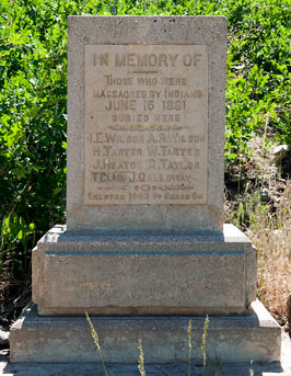
The Pinhook Battle took place June 15, 1881, in the mountains above present-day Moab more than a quarter of a century after the Elk Mountain Mission was abandoned. Thirteen white men and between seven and eighteen Indians were killed.
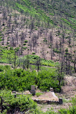
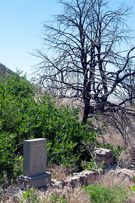
In 1940 Grand County and the Moab Lions Club erected a concrete monument at the site of the common grave in Pinhook Valley where the remains of eight of the thirteen white men killed were buried.
Many place names in this region are derived from the names of the participants in this battle. The region continues to contain descendants of many of those involved.
Except for the Porcupine Ranch, a small piece of private property located about two miles down the valley from the monument, the entire area is unoccupied, undeveloped and under the jurisdiction of the United States Forest Service. It has remained basically the same since the June 1881 incident.
Limited seasonal grazing appears to be the only foreseeable use. There is no surface water in the valley except during periods of heavy snowmelt and cloudbursts.
Excerpted from the NRHP nomination submitted in 1982.

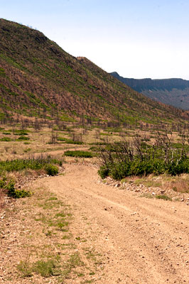
On August 27, 2008 lightning ignited a fire at the lower end of Pinhook Valley. The fire started in pinyon pine and Utah juniper but quickly spread into Gambel oak. These shrubs and trees are extremely combustible and also fairly close to the ground, which allowed the fire to quickly gain speed and move up the Pinhook drainage into the mountains to the southeast.
As the fire gained elevation, it reached stands of aspen and Douglas-fir. Aspen and Douglas-fir tend to be less combustible than oak, pinyon pine, and juniper. The change in vegetation reduced the intensity of the fire, and it soon calmed down enough for firefighters to put in containment lines. Most of the fire spread that you can see from this stop occurred in less than four hours, which meant there was very little time for firefighters or visitors in the area to react. Two forest visitors were hiking from the Miner's Basin trailhead when the fire ignited. They managed to climb a ridge to safety, but their vehicle was destroyed by the fire.
The mountains to east of this stop are Grand View and Horse Mountain. Much of the vegetation on the steep slopes of these mountains burned during the fire. The lack of vegetation makes the risk of erosion very high. Because of this risk, a Burned Area Emergency Response (or BAER) team distributed woodstraw on these steeper slopes to stabilize the soil and speed post-fire recovery. The BAER team also laid out conventional, agricultural straw on the lower, less steep portions of the mountain.
If you drive about a mile and half further down the road, you will see a turnoff to the left (west). This is the Pinhook Valley road. Drive down it to see the effects of the Porcupine Ranch fire up close. As you can see, almost all of the trees in the valley are burned from base to crown, illustrating the intensity of this fire. This is also the location of the historic Pinhook Battleground.
Adapted from an article on the Pinhook Valley Fire of August 2008 which used to be on the Utah State University website.


