Monterey County Points of Interest
Highway 68 and Hitchcock Road
South of Salinas
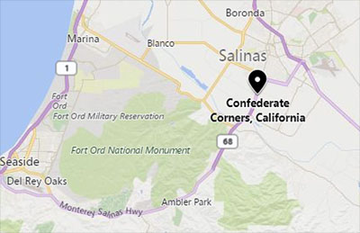
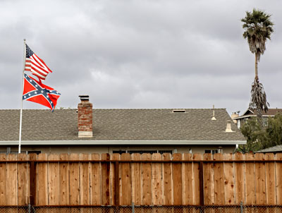
Early in 2018, when I was planning a road trip, I was surprised to see a town named Confederate Corners at the intersection of Highway 68 and Hitchcock Road just south of Salinas.
In 2017, the San Francisco Chronicle also became aware of Confederate Corners and dispatched Kurtis Alexander to interview people who lived or worked there. Although Alexander found that most of them had never heard of Confederate Corners, he did piece together some history:
"County archives suggest the families of two Confederate army captains came to the area in the 1860s and were followed by a handful of other Southerners after their homeland was ravaged by war. They gave the area its name.
"Several maps from the period list Confederate Corners. So does the county’s oldest surviving precinct map, which dates to 1898 and is on display at the elections office in Salinas.
"The early settlement included a general store, blacksmith shop and one of California’s largest wagon-making factories. But the only building still standing from the era is the old barn next to the gas station. Today, there are no signs, plaques or other markers bearing the name."
Source: San Francisco Chronicle

The Monterey County Board of Supervisors, ignoring the preferences of their constituents, voted to change the name to Springtown in honor of Francis and John Spring who moved to the area in the 19th century.
The United States Board on Geographic Names approved the change.


In June of 2018, when I searched Google Maps for Springtown CA, Google placed the pointer at the intersection of Highway 68 and Hitchcock Road. The map displayed the name Springtown.
When I searched for Confederate Corners, Google placed the marker at the same intersection but displayed the new name Springtown.
On 16 June 2018, Bing Maps and Mapquest still displayed Confederate Corners.


