NoeHill Travels in California
Historic Sites and Points of Interest in Kern County
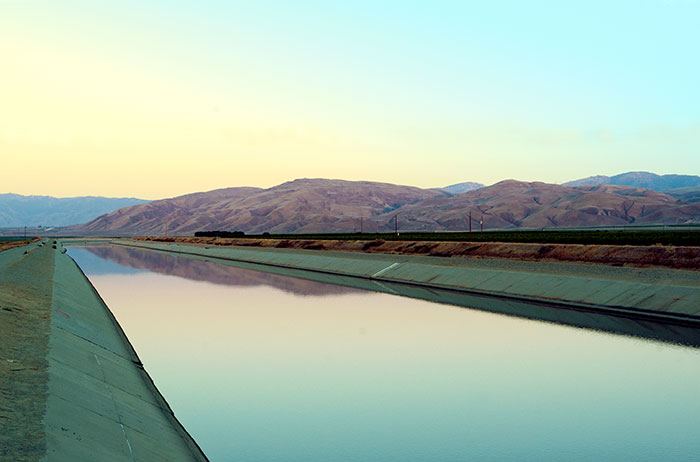
California Aqueduct
15 June 2006
15 June 2006
| Name | Address | City | Year | Authority | ID | Sort Address | Sort Name |
|---|---|---|---|---|---|---|---|
| Alexis Godey Home | 414 19th Street | Bakersfield | California | 690 | Street 19 0414 | Alexis Godey Home | |
| Bakersfield California Building | 1707 Eye Street | Bakersfield | National | 1983001183 | Eye 1707 | Bakersfield California Building | |
| Bandit Rock | Highways 14 and 178 | Freeman | National | 1975000431 | Highway 014 | Bandit Rock | |
| Bealville | Bealville Road | Bealville | California | 741 | Bealville | Bealville | |
| Buena Vista Refinery | SR 33 and Lokern Road | McKittrick | California | 504 | SR 033 | Buena Vista Refinery | |
| Buttonwillow Tree | Buttonwillow Drive | Buttonwillow | California | 492 | Buttonwillow | Buttonwillow Tree | |
| Caliente | Bealville Road | Bealville | California | 757 | Bealville | Caliente | |
| California Standard Oil Well 1 | SR 50 | McKittrick | California | 376 | SR 050 | California Standard Oil Well 1 | |
| Colonel Thomas Baker Memorial | Truxtun and Chester Avenues | Bakersfield | California | 382 | Truxtun | Colonel Thomas Baker Memorial | |
| Desert Spring | Pappas Road Between Valley Road and Munsey Road | Cantil | California | 476 | Pappas | Desert Spring | |
| Edward Kern Campsite | SR 178 at Ramp Area 17 | Lake Isabella | California | 742 | SR 178 | Edward Kern Campsite | |
| Elisha Stevens Home | West Columbus and Isla Verde Streets | Bakersfield | California | 732 | Columbus | Elisha Stevens Home | |
| Errea House | 311 South Green Street | Tehachapi | National | 1997000809 | Green 311 South | Errea House | |
| Fages-Zalvidea Crossing | SR 166 Near Chris Heer Trail | Mettler | California | 291 | SR 166 | Fages-Zalvidea Crossing | |
| First Baptist Church | 1200 Truxtun Avenue | Bakersfield | 1932 | National | 1979000478 | Truxtun 1200 | First Baptist Church |
| Flight of the Gossamer Condor | Lerdo Highway at Vultee Street | Shafter Airport | California | 923 | Lerdo Highway | Flight of the Gossamer Condor | |
| Fort Tejon | Fort Tejon State Historic Park | Fort Tejon | California | 129 | Fort Tejon | Fort Tejon | |
| Fort Tejon | Fort Tejon State Historic Park | Fort Tejon | National | 1971000140 | Fort Tejon | Fort Tejon | |
| The Fort | Ash and Lincoln Streets | Taft | National | 1981000151 | Ash | The Fort | |
| Forty Acres | 30168 Garces Highway | Delano | National | 2008001090 | Garces | Forty Acres | |
| Freeman Junction | SR 178 Near SR 14 | Inyokern | California | 766 | SR 178 | Freeman Junction | |
| Garces Baptismal Site | SR 155 | Woody | California | 631 | SR 155 | Garces Baptismal Site | |
| Garces Circle | Chester Avenue and 30th Street | Bakersfield | 1776 | California | 277 | Chester | Garces Circle |
| Garces Crossing | SR 178 at Rancheria Road | Bakersfield | California | 278 | SR 178 | Garces Crossing | |
| Garces Visit in 1776 | 350 East Bear Mountain Blvd | Arvin | 1776 | California | 371 | Bear Mountain | Garces Visit in 1776 |
| Garlock | Garlock Road | Garlock | California | 671 | Garlock | Garlock | |
| Glennville Adobe | SR 155 Near Pascoe Road | Glennville | California | 495 | SR 155 | Glennville Adobe | |
| Gordon's Ferry | China Grade Loop At Kern River | Bakersfield | California | 137 | China Grade Loop | Gordon's Ferry | |
| Grapevine Pass | Lebec Road Near South Drive | Lebec | California | 283 | Lebec | Grapevine Pass | |
| Green Hotel | 530 James Street | Shafter | National | 1989000204 | James 530 | Green Hotel | |
| Gross House | 18600 Courtlandt Court | Tehachapi | National | 1987000669 | Courtlandt 18600 | Gross House | |
| Havilah | Miller Street and Kern River Canyon Road | Bodfish | California | 100 | Miller | Havilah | |
| Indian Wells | 2565 Highway 14 | Inyokern | California | 457 | Highway 014 | Indian Wells | |
| Jastro Building | 1800 19th Street | Bakersfield | National | 1983001182 | Street 19 1800 | Jastro Building | |
| Jedediah Smith Trail | SR 58 at Towerline Road | Edison | California | 660 | Old Bena | Jedediah Smith Trail | |
| Kern Branch of Beale Memorial Library | 1400 Baker Street | Bakersfield | National | 1981000150 | Baker 1400 | Kern Branch of Beale Memorial Library | |
| Kern River Oilfield | Round Mountain Road at 33 South Road | Oil City | California | 290 | Round Mountain | Kern River Oilfield | |
| Kern River Slough Station | Panama Road Near Cottonwood Road | Lamont | California | 588 | Highway 244 | Kern River Slough Station | |
| Kernville | Wofford Boulevard at Burlando Road in Old Kernville Cemetery | Kernville | California | 132 | Wofford | Kernville | |
| Keysville | Keysville Road West of Black Canyon Road | Keyesville | California | 98 | Keysville | Keysville | |
| Lakeview Gusher 1 | Petroleum Club RoadBetween Kerto and Cadet Roads | Maricopa | California | 485 | Petroleum Club | Lakeview Gusher 1 | |
| Lavers Crossing | White River Road and Jack Ranch Drive | Glennville | California | 672 | White River | Lavers Crossing | |
| McKittrick Brea Pit | SR 33 and SR 58 | McKittrick | 1926 | California | 498 | Highway 033 | McKittrick Brea Pit |
| Mojave 20-Mule Team Borax Terminus | 16246 Sierra Highway (Highway 14) | Mojave | California | 652 | Sierra 16246 | Mojave 20-Mule Team Borax Terminus | |
| Mountain House | Bakersfield-Glenville Road Near Woody Road | Woody | California | 589 | Bakersfield-Glennville | Mountain House | |
| NASA Dryden Flight Research Center Building 4802 | 2825 E Avenue P | Edwards Air Force Base | National | 2006000656 | Avenue P | NASA Dryden Flight Research Center Building 4802 | |
| Oak Creek Pass | Tehachapi Willow Springs Road | Tehachapi | California | 97 | Tehachapi | Oak Creek Pass | |
| Posey Station | Bakersfield-Glennville Road and Round Mountain Road | Bakersfield | California | 539 | Bakersfield-Glennville | Posey Station | |
| Rand Mining District | Butte Avenue and Highland Avenue | Johannesburg | California | 938 | Butte | Rand Mining District | |
| Rogers Dry Lake | Edwards Air Force Base | Mojave Desert | National | 1985002816 | Edwards Air Force Base | Rogers Dry Lake | |
| Rose Station | Grapevine Road and Rose Station Road | Grapevine | California | 300 | Grapevine | Rose Station | |
| Santa Fe Passenger and Freight Depot | 150 Central Valley Highway | Shafter | National | 1982002187 | Central Valley 150 | Santa Fe Passenger and Freight Depot | |
| Sebastian Indian Reservation | Grapevine Road and Rose Station Road | Grapevine | California | 133 | Grapevine | Sebastian Indian Reservation | |
| Shafter Cotton Research Station | 17053 Shafter Avenue | Shafter | California | 1022 | Shafter 17053 | Shafter Cotton Research Station | |
| Shafter Cotton Research Station | 17053 Shafter Avenue | Shafter | National | 1997001211 | Shafter 17053 | Shafter Cotton Research Station | |
| Sinks of the Tejón | David and Wheeler Ridge Roads | Meridian | California | 540 | David | Sinks of the Tejón | |
| Tehachapi Loop | Old Highway, 3.2 Miles East of Keene Exit, 6.5 Miles West of Tehachapi | Tehachapi | California | 508 | Old Highway | Tehachapi Loop | |
| Tehachapi Old Town | Old Town Road and Woodford-Tehachapi Road | Tehachapi | California | 643 | Old Town | Tehachapi Old Town | |
| Tehachapi Railroad Depot | 101 West Tehachapi Boulevard | Tehachapi | 1904 | National | 1999001263 | Tehachapi W 0101 | Tehachapi Railroad Depot |
| Tevis Block | 1712 19th Street | Bakersfield | 1893 | National | 1984000780 | Street 19 1712 | Tevis Block |
| Tulamniu Indian Site | Block House #BV4 North of Buena Vista Pumping Station | Taft | California | 374 | Blockhouse | Tulamniu Indian Site | |
| Valencia House | 1020 High Street | Delano | National | 1972001549 | High 1020 | Valencia House | |
| Walker Pass | SR 178 at Pacific Crest Trail | Scodie Mountains | California | 99 | SR 178 | Walker Pass | |
| Walker Pass | SR 178 at Pacific Crest Trail | Scodie Mountains | National | 1966000210 | SR 178 | Walker Pass | |
| Wasco Union High School Auditorium | 1900 Seventh Street | Wasco | National | 1997001188 | Street 07 1900 | Wasco Union High School Auditorium | |
| Weedpatch Camp | 8305 Sunset Boulevard | Bakersfield | National | 1995001554 | Sunset 8305 | Weedpatch Camp | |
| Well 2-6 | Broadway and Midway Road | Fellows | California | 581 | Broadway | Well 2-6 | |
| Willow Springs | 4040 Manly Road | Rosamond | California | 130 | Manly | Willow Springs |