NoeHill Travels in California
Historic Sites and Points of Interest in San Benito County

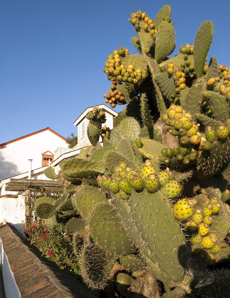
Gigantic Prickly Pear Cactus Near Plaza Hotel
San Juan Bautista (Population c.1,862)
30 September 2011

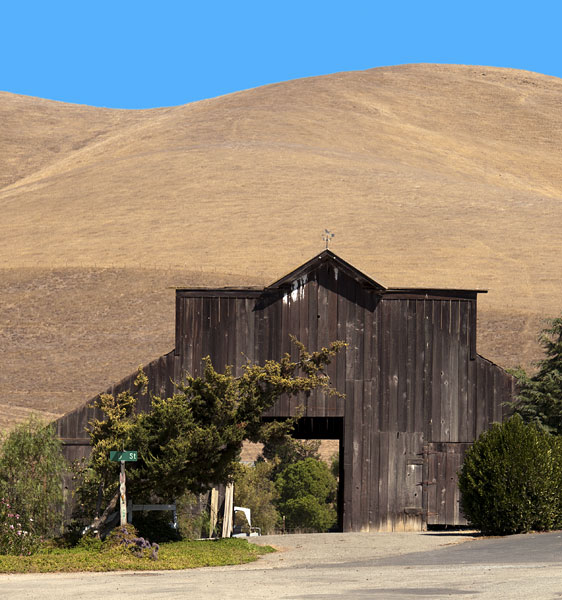
5th and D Streets
Tres Pinos (Population c.476)
1 October 2011
(Click Photos to Zoom)
| Name | Address | City | Year | Authority | ID | Sort Address | Sort Name |
|---|---|---|---|---|---|---|---|
| 19th Hole Rendevous | SR 25 Between 1st and 3rd Streets | Tres Pinos | POI | 025-20 | 19th Hole Rendevous | ||
| Anza House | Plaza | San Juan Bautista | National | 1970000140 | Plaza | Anza House | |
| Benitoite | Coalinga Road at Union Carbide Road | San Benito County | POI | Coalinga | Benitoite | ||
| Castro House | Plaza | San Juan Bautista | 1840 | California | 179 | Plaza | Castro House |
| Castro House | Plaza | San Juan Bautista | 1840 | National | 1970000141 | Plaza | Castro House |
| Condor Crags | Route 146 at Juniper Canyon Trail | Pinnacles National Park | POI | 146-05 | Condor Crags | ||
| Cottage Corners | Route 25 | San Benito County Historical Park | POI | Route 25 | Cottage Corners | ||
| Cottage Corners Marker | San Felipe Road and Wright Road | Hollister | POI | San Felipe | Cottage Corners Marker | ||
| De Anza Expedition | 2nd Street at Polk Street | San Juan Bautista | POI | Street 02-50 | De Anza Expedition | ||
| El Camino Real Bell | 2nd and Mariposa Streets | San Juan Bautista | POI | Street 02-40 | El Camino Real Bell | ||
| Fremont Peak | San Juan Canyon Road | Fremont Peak State Park | POI | San Juan Canyon | Fremont Peak | ||
| Fremont Peak Marker | Muckelemi Between 4th and 5th | San Juan Bautista | 1846 | California | 181 | Muckelemi | Fremont Peak Marker |
| Hawkins House | 801 South Street | Hollister | National | 1993000669 | South 0801 | Hawkins House | |
| Hollister Carnegie Library | 375 Fifth Street | Hollister | National | 1992000269 | Street 05-10 | Hollister Carnegie Library | |
| Hollister Historic District | Bounded by Monterey, Fourth, East, South Streets | Hollister | National | 1992000974 | Monterey 0000 | Hollister Historic District | |
| Hollister Southern Pacific Depot | 35 Fifth Street | Hollister | POI | Street 05 0035 | Hollister Southern Pacific Depot | ||
| Hollister Train Service | 5th and Sally Streets | Hollister | POI | Street 05-00 | Hollister Train Service | ||
| Laguna Mountain Campground | Laguna Mountain Road | San Benito County | POI | Laguna Mountain | Laguna Mountain Campground | ||
| Limekiln Monorail | Cienega Road | Paicines | POI | Cienega | Limekiln Monorail | ||
| Marentis House | 45 Monterey Street | San Juan Bautista | National | 1984000951 | Monterey 0045 | Marentis House | |
| McCallum House | 1401 San Benito Street | Hollister | National | 1997001445 | San Benito 1401 | McCallum House | |
| Mission San Juan Bautista and Plaza | Plaza | San Juan Bautista | 1790 | California | 195 | Plaza | Mission San Juan Bautista and Plaza |
| Monterey Street Historic District | Monterey Between 5th and B | Hollister | National | 1992001740 | Monterey 0000 | Monterey Street Historic District | |
| New Idria Mine Marker | Route 25 at Panoche Road | Paicines | 1850 | California | 324 | 025-30 | New Idria Mine Marker |
| Palmtag Cutting Shed | Route 25 | San Benito County Historical Park | POI | Route 25 | Palmtag Cutting Shed | ||
| Pinnacles Visitor Center | 5000 Route 146 | Pinnacles National Park | POI | 146-10 | Pinnacles Visitor Center | ||
| Plaza Hall | Plaza | San Juan Bautista | POI | Plaza | Plaza Hall | ||
| Plaza Hotel | Plaza | San Juan Bautista | 1858 | California | 180 | Plaza | Plaza Hotel |
| Plaza Stable | Plaza | San Juan Bautista | POI | Plaza | Plaza Stable | ||
| Raymond F. Eade Memorial | Coalinga Road Near Clear Creek Road | San Benito County | POI | Coalinga | Raymond F. Eade Memorial | ||
| Rozas House | 31 Polk Street | San Juan Bautista | National | 1982002243 | Polk 0031 | Rozas House | |
| San Andreas Fault | Plaza | San Juan Bautista | POI | Plaza | San Andreas Fault | ||
| San Juan Bautista Plaza | 2nd and Mariposa Streets | San Juan Bautista | 1790 | National | 1969000038 | Street 02-30 | San Juan Bautista Plaza |
| San Juan Bautista Third Street Historic District | 3rd Street (From 406 3rd to Franklin) | San Juan Bautista | National | 2008001277 | Street 03-00 | San Juan Bautista Third Street Historic District | |
| Tres Pinos Hotel Site | SR 25 at 5th Street | Tres Pinos | POI | 025-10 | Tres Pinos Hotel Site | ||
| Tres Pinos/Paicines | SR 25 at Panoche Road | Paicines | POI | 025-40 | Tres Pinos/Paicines | ||
| Vineyard School | Cienega Road | Paicines | POI | Cienega | Vineyard School | ||
| Wilcox House | 315 The Alameda | San Juan Bautista | National | 1982002244 | Alameda 0315 | Wilcox House | |
| Wino Willie | 526 San Benito Street | Hollister | POI | San Benito 0526 | Wino Willie |