Historic Sites and Points of Interest in Esmeralda County

23 February 2007
(Click Photo to Zoom)
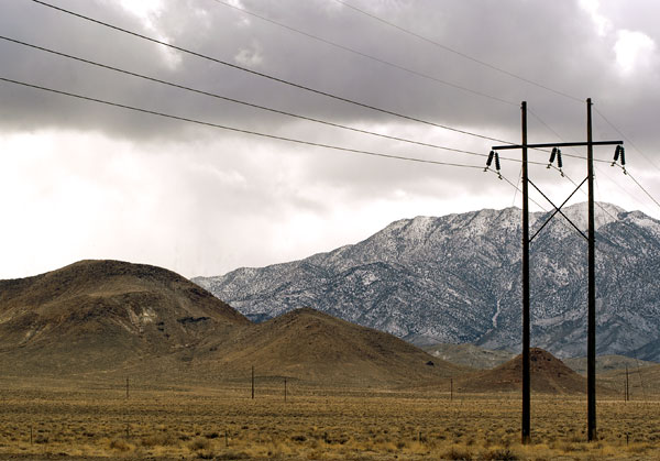
Esmeralda County, with a population of fewer than 1,300 souls in 2006, is the emptiest county in Nevada. Three square miles (about seven square kilometers) for each person.
The mountainous terrain contains Nevada's highest elevation, Boundary Peak, 13,147 feet (4,007 meters) above sea level. Just west of Esmeralda County the mountains descend into Death Valley, California.
Esmeralda County was created in 1861 as one of the nine original Nevada counties and took its name from the Esmeralda Mining District which had been named by the miner J. M. Corey. Although esmeralda is Spanish for emerald, Corey probably named the mining district not after the precious stone but after the gypsy in The Hunchback of Notre Dame.
Goldfield, the county seat, is situated on US 95, The Silver Trail, between Tonopah and Las Vegas. Goldfield was incorporated in 1902 when gold was discovered nearby. By 1906, eight hundred tons of gold had been mined in the district. At the apex of its glory in 1907, Goldfield was the largest and most powerful city in Nevada with its population somewhere north of 15,000. Today Goldfield has fewer than five hundred souls.
Wyatt Earp was a deputy sheriff in Goldfield for a few months. He left town in 1905 when his brother Virgil died.
| Name | Address | City | Year | Authority | ID | Sort Address | Sort Name |
|---|---|---|---|---|---|---|---|
| Blair | SR 265 | Blair | Nevada | 174 | Highway 265 | Blair | |
| Columbus | US 95 | Columbus | 1865 | Nevada | 20 | Highway 095 | Columbus |
| Esmeralda County Courthouse | 233 CrookAvenue | Goldfield | 1908 | POI | Crook 0233 | Esmeralda County Courthouse | |
| Fish Lake Valley | SR 264 | Dyer | Nevada | 133 | Highway 264 | Fish Lake Valley | |
| Gold Point | SR 774 | Gold Point | 1880 | POI | Highway 774 | Gold Point | |
| Gold Point Nevada Marker | SR 266 at SR 774 | Gold Point | 1880 | Nevada | 156 | Highway 266 | Gold Point Nevada Marker |
| Goldfield | East Crook Aveneue at North Euclid Avenue | Goldfield | 1902 | Nevada | 14 | Crook | Goldfield |
| Goldfield Fire Station No. 1 | Euclid Avenue and Crook Avenue | Goldfield | 1908 | POI | Euclid | Goldfield Fire Station No. 1 | |
| Goldfield Historic District | Bounded by 5th Street, Miner, Spring, Crystal and Elliott Avenues | Goldfield | National | 1982003213 | Goldfield Historic District | ||
| Goldfield Hotel | Crook Avenue and Columbia Street | Goldfield | 1908 | POI | Crook | Goldfield Hotel | |
| Lida | SR 266 | Lida | Nevada | 157 | Highway 266 | Lida | |
| Millers | US 95 | Millers Rest Area | 1904 | Nevada | 101 | Highway 095 | Millers |
| Palmetto | SR 266 | Palmetto | Nevada | 158 | Highway 266 | Palmetto | |
| Silver Peak Ghost Town | US 95 at SR 265 | Goldfield | 1863 | Nevada | 155 | Highway 095 | Silver Peak Ghost Town |
| Silver Peak Marker | US 95 at SR 265 | Goldfield | 1863 | Nevada | 155 | Highway 095 | Silver Peak Marker |
| Southern Nevada Consolidated Telephone-Telegraph Company Building | 206 East Ramsey Street | Goldfield | Nevada | 242 | Ramsey | Southern Nevada Consolidated Telephone-Telegraph Company Building |