Historic Sites and Points of Interest in Fresno County
15 June 2006
The area now known as Fresno County, was discovered by Spaniards during a search for suitable mission sites. In 1846, this area became the property of the United States as a result of the Mexican War.
Fresno County was formed in 1856 from parts of Mariposa, Merced and Tulare counties. Fresno is Spanish for "Ash" and it was due to the abundance of the shrubby local Ash tree, fraxinus dipetala, growing along the San Joaquin River that it received its name.
Parts of Fresno County's territory were given to Mono County in 1861 and to Madera County in 1893.
The original county seat was along the San Joaquin River in Millerton, but was moved to the rapidly growing town of Fresno on the newly built Southern Pacific Railroad line after a flood destroyed much of the town.
Source: Wikipedia
| Name | Address | City | Year | Authority | ID | Sort Address | Sort Name |
|---|---|---|---|---|---|---|---|
| Armenian Apostolic Church | 2226 Ventura Street | Fresno | National | 1986002097 | Ventura 2226 | Armenian Apostolic Church | |
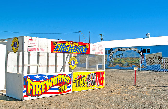
| Arroyo de Cantua | SR 198 and SR 133 Intersection | Coalinga | 1853 | California | 344 | SR 198 | Arroyo de Cantua |
| Bank of Italy | 1015 Fulton Mall | Fresno | 1917 | National | 1982000963 | Fulton 1015 | Bank of Italy |
| Brix Mansion | 2844 Fresno Street | Fresno | 1911 | National | 1983001178 | Fresno 2844 | Brix Mansion |
| Coalinga Polk Street School | South 5th and East Polk Streets | Coalinga | National | 1982002175 | Street 5 | Coalinga Polk Street School | |
| Dinkey Creek Bridge | McKinley Grove Road | Sierra National Forest | National | 1996000911 | McKinley Grove | Dinkey Creek Bridge | |
| Einstein House | 1600 M Street | Fresno | 1912 | National | 1978000662 | Street M 1600 | Einstein House |
| First Junior College in California | Stanislaus and O Streets | Fresno | California | 803 | Stanislaus | First Junior College in California | |
| Forestiere Underground Gardens | 5021 West Shaw Avenue | Fresno | 1906 | California | 916 | Shaw 5021 | Forestiere Underground Gardens |
| Forestiere Underground Gardens | 5021 West Shaw Avenue | Fresno | 1906 | National | 1977000293 | Shaw 5021 | Forestiere Underground Gardens |
| Fort Miller | 5290 Millerton Road | Friant | California | 584 | Millerton 5290 | Fort Miller | |
| Fresno Bee Building | 1555 Van Ness Avenue | Fresno | 1922 | National | 1982000964 | Van Ness 1555 | Fresno Bee Building |
| Fresno Brewing Company | 100 M Street | Fresno | 1907 | National | 1984000773 | Street M 0100 | Fresno Brewing Company |
| Fresno City | Fresno Slough North of James Road | Tranquillity | California | 488 | Fresno Slough | Fresno City | |
| Fresno IWW Free Speech Fight | Broadway and Mariposa Mall | Fresno | California | 873 | Broadway | Fresno IWW Free Speech Fight | |
| Fresno Memorial Auditorium | 2425 Fresno Street | Fresno | 1935 | National | 1994000427 | Fresno 2425 | Fresno Memorial Auditorium |
| Fresno Republican Printery Building | 2120 North Kern Street | Fresno | 1919 | National | 1979000474 | Kern 2120 | Fresno Republican Printery Building |
| Gamlin Cabin | North Grove Trail | Sequoia-Kings Canyon National Park | National | 1977000123 | North Grove | Gamlin Cabin | |
| Hotel Californian | 851 Van Ness Avenue | Fresno | National | 2004000333 | Van Ness 0851 | Hotel Californian | |
| Japanese American Detention Camp | 1141 South Chance Avenue | Fresno | California | 934 | Chance S 1141 | Japanese American Detention Camp | |
| Japanese American Detention Camp | Blackstone Avenue at Highway 41 | Pinedale | California | 934 | Blackstone | Japanese American Detention Camp | |
| Jensen Ranch | 8262 Bethel Avenue | Selma | National | 1982004980 | Bethel 8262 | Jensen Ranch | |
| Kearney Park and Mansion | 7160 Kearney Boulevard | Fresno | 1903 | National | 1975000426 | Kearney 7160 | Kearney Park and Mansion |
| Kindler House | 1520 East Olive Avenue | Fresno | 1929 | National | 1982000965 | Olive 1520 | Kindler House |
| Knapp's Cabin | North Cedar Grove Road at Motor Nature Trail | Kings Canyon National Park | National | 1978000291 | Cedar Grove | Knapp's Cabin | |
| Maubridge Apartments | 2344 Tulare Street | Fresno | 1911 | National | 1982002176 | Tulare 2344 | Maubridge Apartments |
| Meux House | 1007 R Street | Fresno | 1888 | National | 1975000427 | Street R 1007 | Meux House |
| Old Administration Building of Fresno City College | 1101 University Avenue | Fresno | 1916 | National | 1974000510 | University 1101 | Old Administration Building of Fresno City College |
| Old Fresno Water Tower | 2444 Fresno Street | Fresno | 1894 | National | 1971000139 | Fresno 2444 | Old Fresno Water Tower |
| Orange Cove Santa Fe Railway Depot | 633 East Railroad Avenue | Orange Cove | National | 1978000668 | Railroad | Orange Cove Santa Fe Railway Depot | |
| Pantages Theater | 1400 Fulton Street | Fresno | 1929 | National | 1978000663 | Fulton 1400 | Pantages Theater |
| Physicians Building | 2607 Fresno Street | Fresno | 1926 | National | 1978000664 | Fresno 2607 | Physicians Building |
| Reedley National Bank | 1100 G Street | Reedley | National | 1985000352 | Street G 1100 | Reedley National Bank | |
| Reedley Opera House Complex | 10th and G Streets | Reedley | National | 1984000774 | Street 10 | Reedley Opera House Complex | |
| Rehorn House | 1050 S Street | Fresno | 1906 | National | 1982002177 | Street S 1050 | Rehorn House |
| Romain House | 2055 San Joaquin Street | Fresno | 1905 | National | 1982002178 | San Joaquin 2055 | Romain House |
| San Joaquin Light & Power Corporation Building | 1401 Fulton Street | Fresno | National | 2005001497 | Fulton 1401 | San Joaquin Light & Power Corporation Building | |
| Santa Fe Hotel | 935 Santa Fe Avenue | Fresno | 1913 | National | 1991000287 | Santa Fe 0935 | Santa Fe Hotel |
| Santa Fe Passenger Depot | 2650 Tulare Street | Fresno | 1899 | National | 1976000482 | Tulare 2650 | Santa Fe Passenger Depot |
| Shorty Lovelace Historic District | East of Pinehurst in Kings Canyon National Park | Pinehurst | National | 1978000293 | Pinehurst | Shorty Lovelace Historic District | |
| Southern Pacific Passenger Depot | 1713 Tulare Street | Fresno | 1889 | National | 1978000665 | Tulare 1713 | Southern Pacific Passenger Depot |
| Stoner House | 21143 East Weldon Avenue | Sanger | National | 1985003145 | Weldon 21143 | Stoner House | |
| Tower Theatre | 1201 North Wishon Avenue | Fresno | 1939 | National | 1992001276 | Wishon 1201 | Tower Theatre |
| Twining Laboratories | 2527 Fresno Street | Fresno | 1930 | National | 1991000308 | Fresno 2527 | Twining Laboratories |
| Warehouse Row | 722, 744, and 764 P Street | Fresno | 1903 | National | 1978000666 | Street P 722 | Warehouse Row |
| Y.W.C.A. Building | 1660 M Street | Fresno | 1922 | National | 1978000667 | Street M 1660 | Y.W.C.A. Building |